
From field capture to finished data.
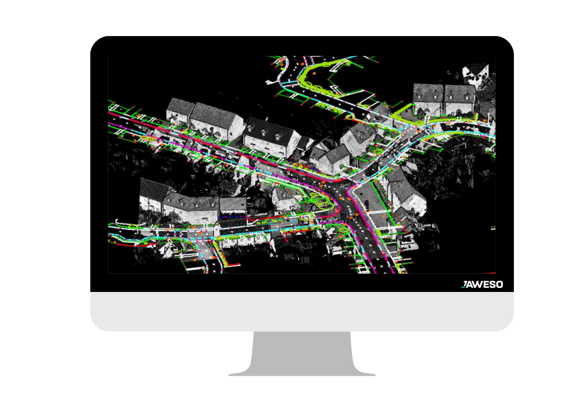
We connect data capture and processing in one seamless workflow.
We provide a complete software workflow for efficient Mobile Mapping data acquisition and processing.
With JAWESO Capture, users can easily control and monitor the system through a browser-based interface accessible from a laptop or tablet via Wi-Fi, network cable, or optionally remotely. The intuitive WebUI supports project-based workflows, allowing users to create projects, continue them across multiple days, preview live images, monitor system status in real time, manage map layers, upload external files, and configure advanced positioning and trigger settings.
Once the data has been captured, JAWESO Office delivers powerful post-processing for the entire workflow. The Windows-based software with its browser-based interface enables efficient panorama generation, point cloud optimization, synchronization, colorization, and direct viewer upload. All results are exported in standard formats, ensuring seamless integration into third-party software and downstream workflows.
JAWESO Capture
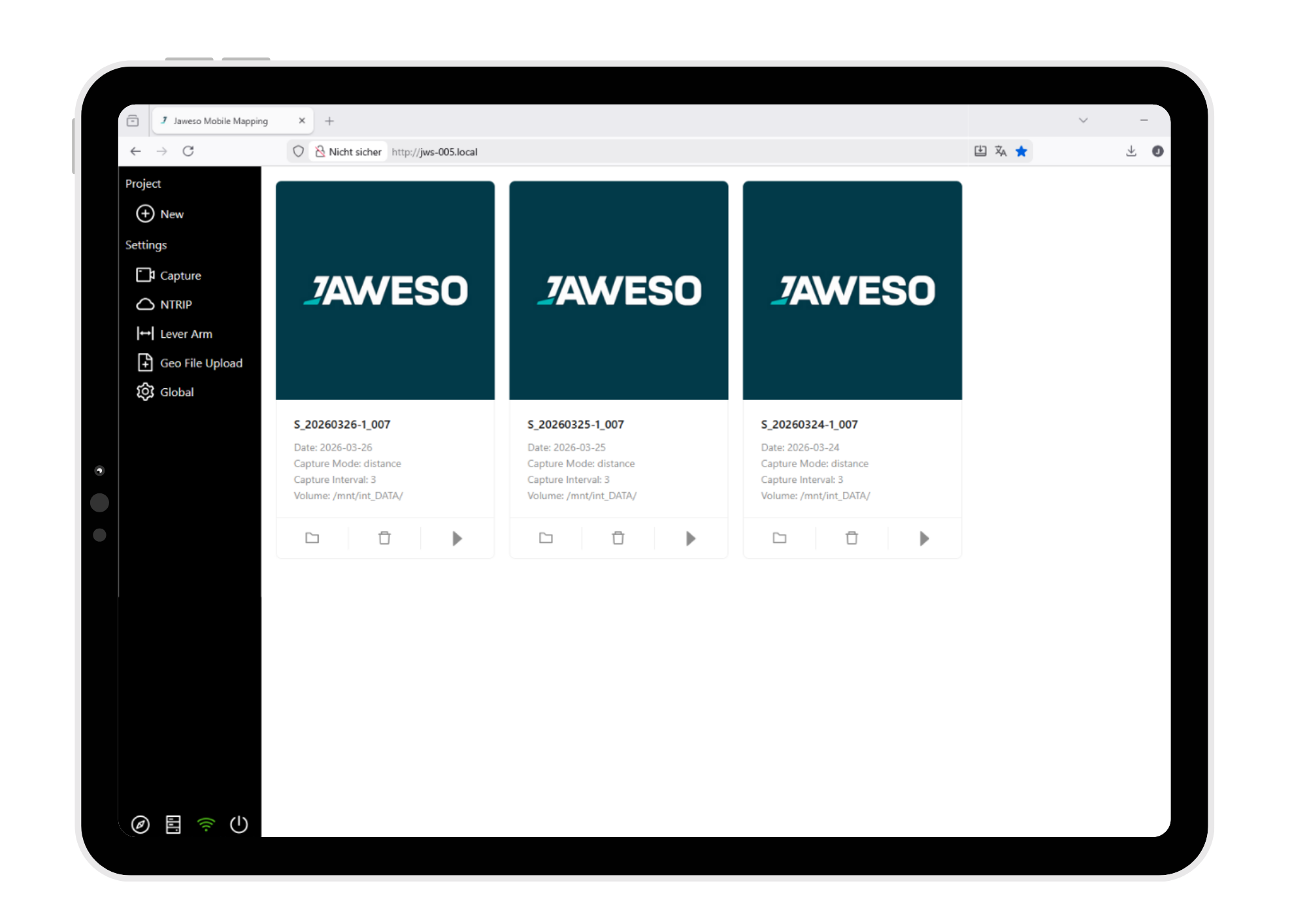
Connected Workflow and System Control
- WebUI access via Wi-Fi or Ethernet
- Project-based workflow
- Continue projects across multiple days
- Advanced positioning and trigger settings
- Remote support access by JAWESO when required
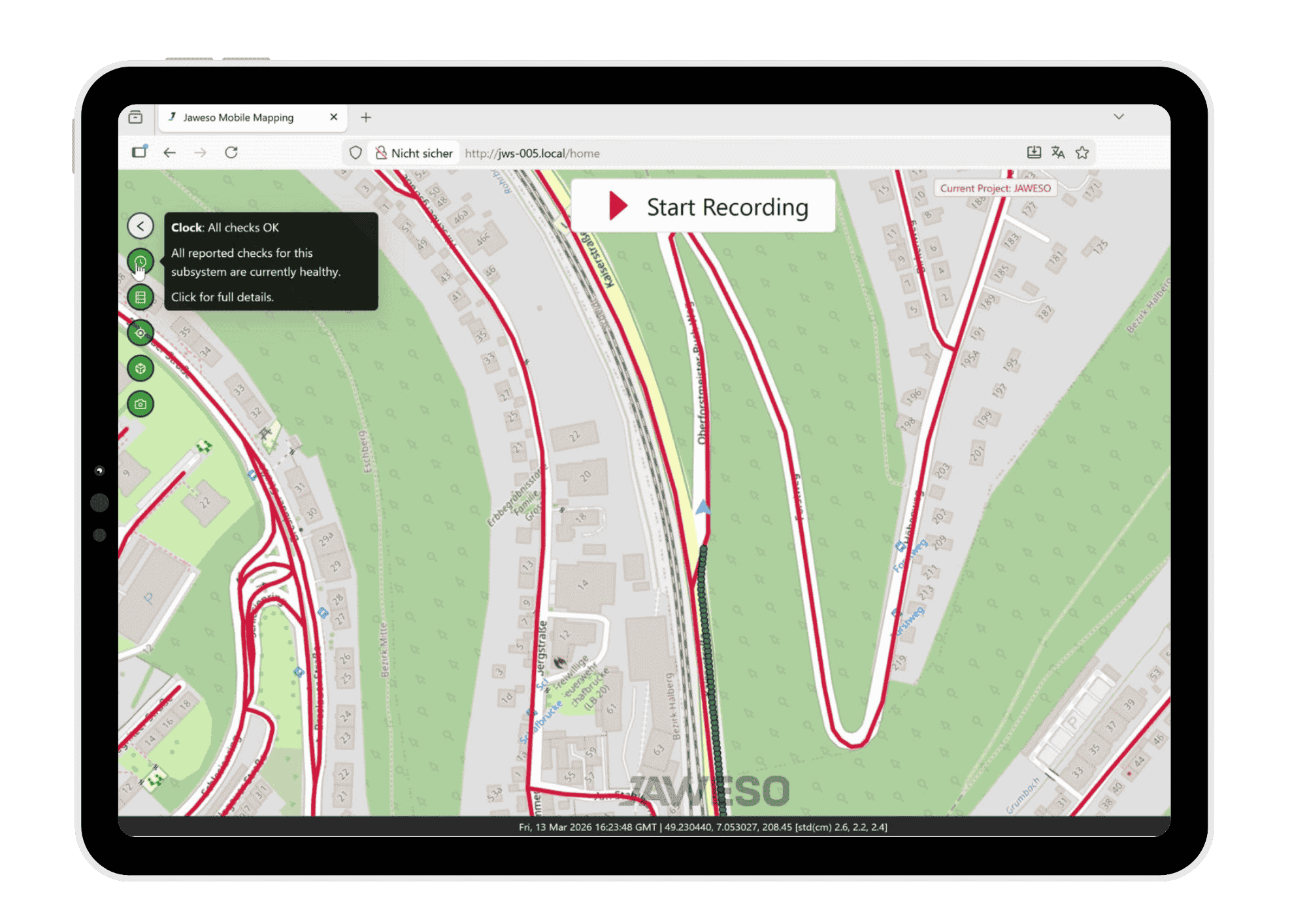
Monitoring and Map-Based Visualization
- Map view with optional satellite and Railway-Map layers
- Status bar for camera temp., system load, and storage
- Live image preview
- Upload KML, KMZ, and SHP files
- Display recorded trajectories
JAWESO Office
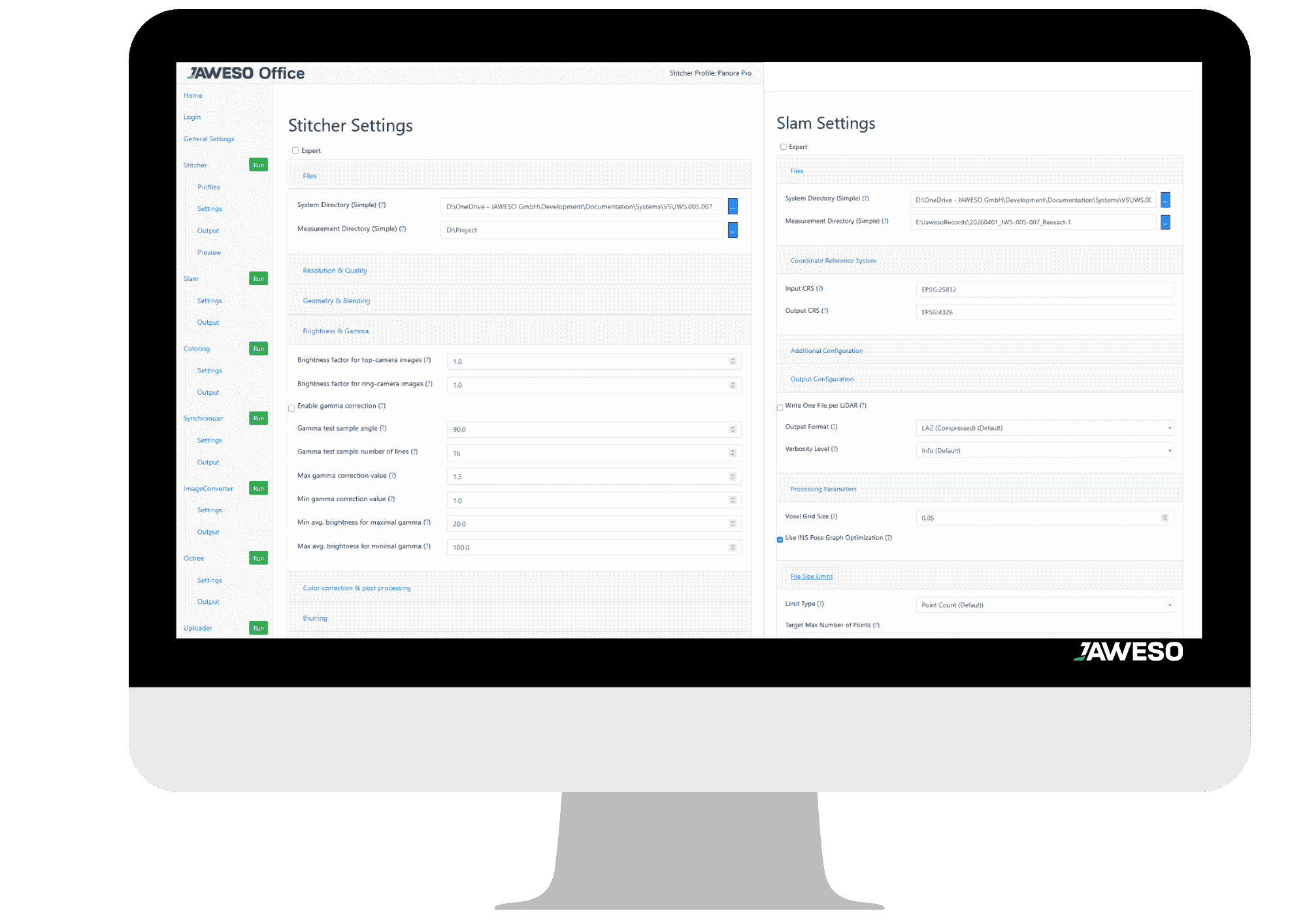
Powerful post-processing for panoramas, point clouds, synchronization and direct viewer upload.
- Panorama generation: Stitches single images into panoramas with optional GDPR-compliant anonymization of faces and license plates, plus advanced image adjustment and filtering options.
- DoubleSLAM point cloud optimization: Further improves the real-time point cloud based on raw data, with optional filters such as moving object removal.
- Point cloud colorization: Colors the point cloud using the generated panoramas.
- Data synchronization: Synchronizes all datasets, including trigger positions, optimized trajectories, external trajectories, lever arms, and angular offsets.
- Direct viewer upload: Uploads processed data directly to viewers such as MapTerra, with integration of other solutions also possible.
Mobile Mapping DEMO
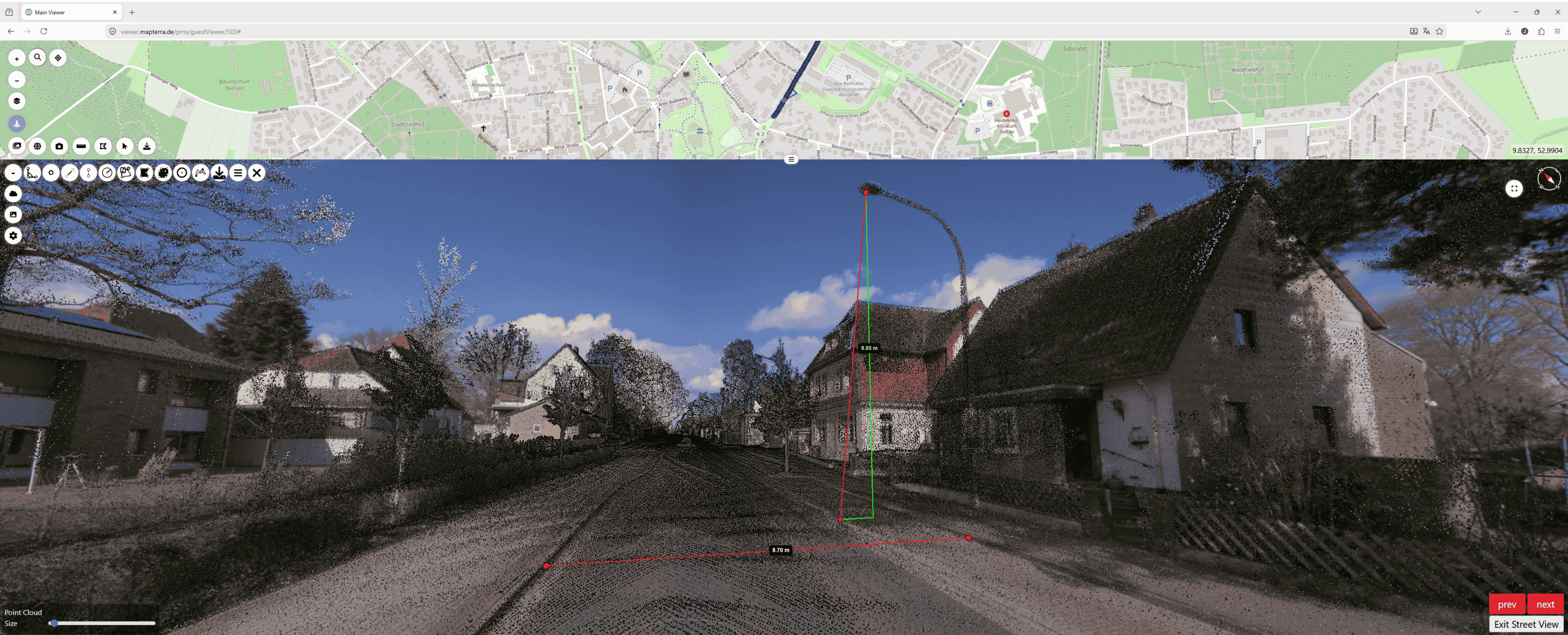
Example publication of the JAWESO Panora Pro PL in the MapTerra Viewer
MapTerra Viewer
All data captured with JAWESO systems, as well as the results generated in JAWESO Office, are provided in common standard formats and can be used flexibly in a wide range of applications.
On request, we also offer the viewer of our partner MapTerra GmbH. It enables convenient browser-based visualization and provision of your data. If required, MapTerra can also provide additional services related to data processing, publication, and delivery.
Where high-resolution mapping becomes visible
Get in touch!
Contact us for inquiries, questions and personal consultation.