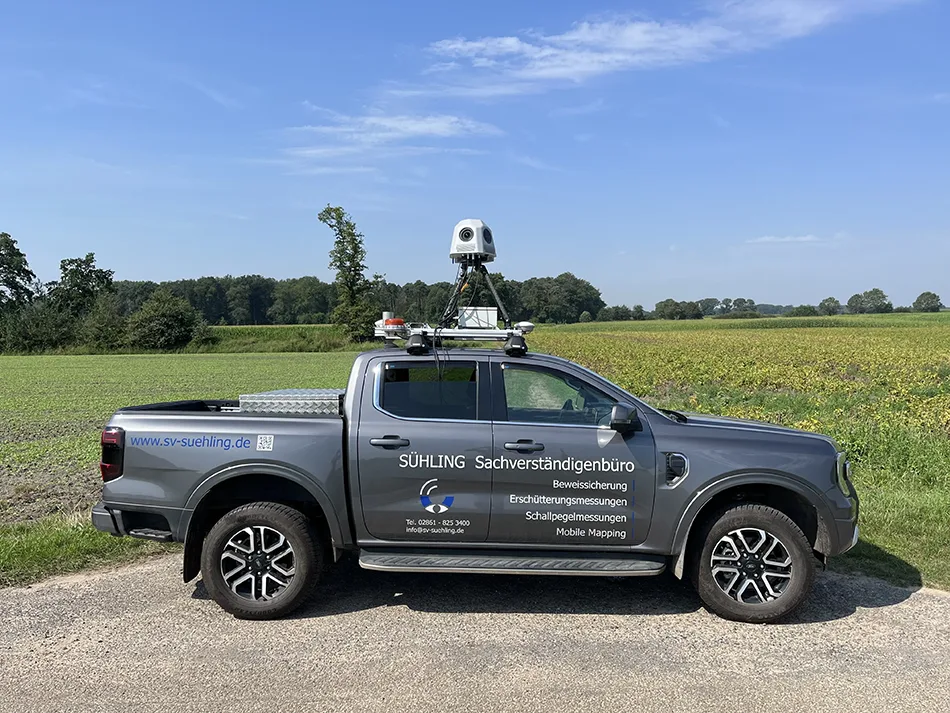
Our camera systems allow capturing of detailed street, urban infrastructure or railway industry information.
With our innovative Mobile Mapping solutions, we enable the visual inspection of spatial environments and the creation of digital twins of infrastructures in the highest resolution quality. Our 3D models are particularly popular with local authorities, construction companies, infrastructure operators, utility companies and FTTX projects, as they provide a reliable basis for the planning, calculation and realization of a wide range of infrastructure projects.
JAWESO GmbH specializes in high-resolution mobile mapping camera systems. Based in Soltau, Lower Saxony, we develop and produce advanced camera solutions for the precise mapping of roads, urban infrastructure and railway systems. Our goal is to maximize efficiency and accuracy in the visualization and documentation of infrastructures through continuous innovation and technological leadership.
Benefits of JAWESO Mobile Mapping Systems
Shortening the time for inspections
Our systems capture high-resolution images and data in real time, which significantly reduces inspection times. This enables faster and more efficient inspection of infrastructure without compromising on accuracy.
Rationalization of the planning phase
The detailed 3D models and digital twins generated by our systems provide comprehensive and precise data. This data supports more accurate and efficient project planning by providing clear and reliable information.
Acceleration of projects
The precise and immediate data capture by our camera systems significantly reduces project lead times. As a result, projects can be started and completed faster, leading to higher productivity and cost efficiency.
Improved documentation
Thanks to the high-resolution imaging capabilities of our cameras, improved and accurate documentation is achieved. These detailed records are highly reliable for future reference and compliance purposes and contribute to long-term quality assurance.
What our customers say
"As a publically appointed expert office, we use the AquiView Panorama system for inspections and documentation in various sectors. The system is extremely reliable, delivering high-quality, 360° images, even under tough conditions. The GNSS-supported archiving makes it easy for clients to access and view the images, much like 'StreetView.' JAWESO's service is outstanding, always ready to assist, although the system runs so smoothly that support is rarely needed."
Thomas Buskasper, Field Measurement Specialist of SÜHLING Sachverständigenbüro GmbH
Our mission
Our mission is to revolutionize the digitization and visualization of infrastructures through cutting-edge technology and precise imaging. With our high-quality mobile mapping systems, we are setting standards in the industry. Our products are characterized by their extremely high image resolution and precise level of detail, making it possible to create digital twins of infrastructures in unprecedented quality. These digital twins serve as an indispensable basis for the planning, calculation and realisation of a wide range of infrastructure projects by providing precise data that exceeds previous standards.
Our commitment to quality is central to our corporate philosophy. We continuously strive to develop our technology and ensure that our products meet not only current but also future requirements and challenges. This ambition drives us to not only lead the industry, but also to provide sustainable and efficient solutions that redefine industry standards.
Get in touch!
Contact us for inquiries, questions and personal consultation.


