
High Resolution Mobile Mapping Systems
Our Mobile Mapping Systems allow capturing of detailed street, urban infrastructure or railway industry information.
With our innovative solutions, we enable the visual inspection of spatial environments. The solutions help creating digital twins of infrastructures in the highest resolution quality possible. 3D models can be generated for municipalities, construction companies, infrastructure operators, utilities or FTTx. These can be used as a basis for the planning, calculation and realization of all kinds of infrastructure projects.
Our solution
Extremely detailed and accurate recordings
- BIM modelling
- Digital twins
- Damage identification on roads, railways, in tunnels, factory buildings
- Mass calculations
- Construction progress control or documentation
- Road assessment
- As-built data collection
- FTTx planning
- HD maps for autonomous driving
Our products

Discover all our products
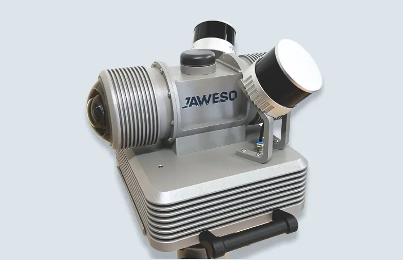
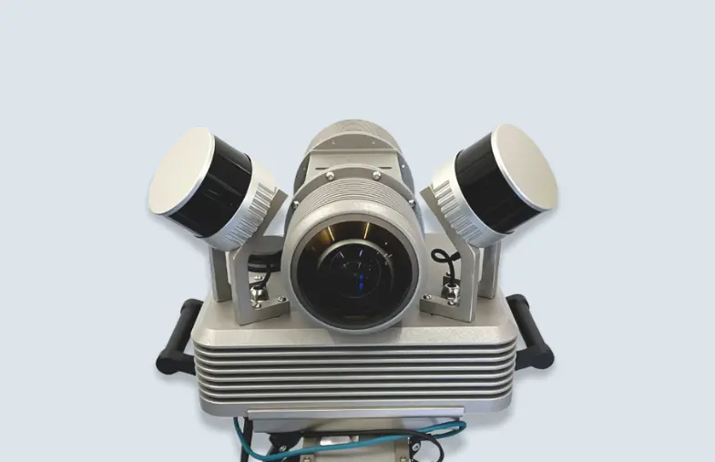
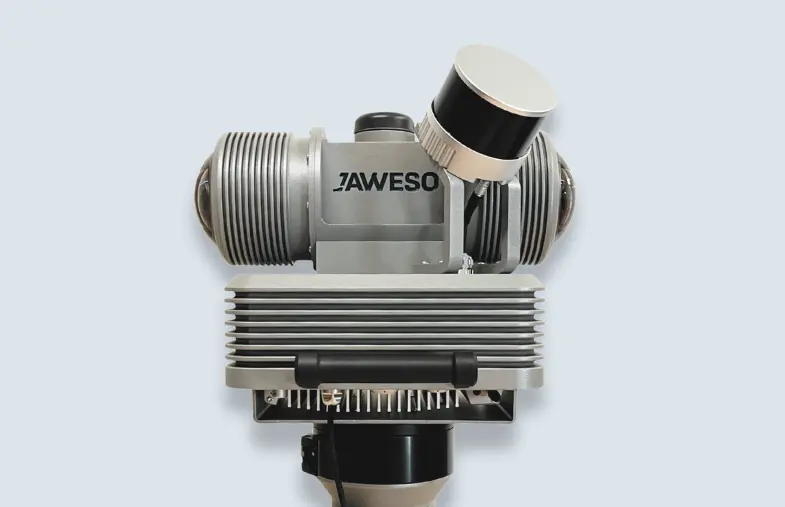
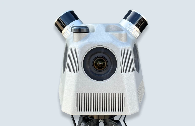
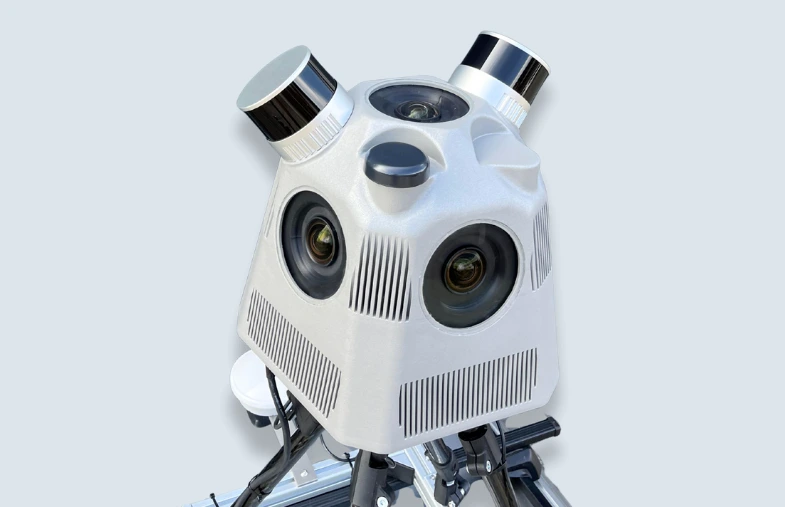
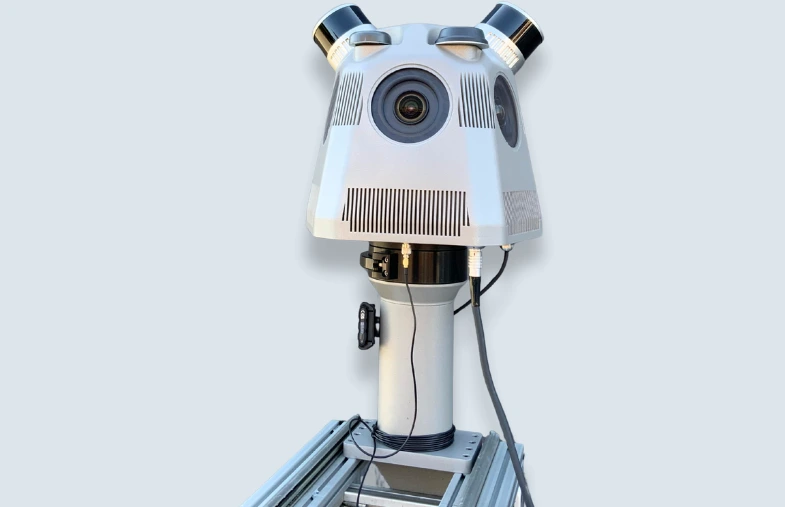
Our JAWESO Panora in action
Use Cases

Infrastructure Inspection and Maintenance
Our Mobile Mapping Systems are ideal for inspecting and maintaining infrastructure. High-resolution imagery and accurate point clouds data enable detailed assessment of roads, bridges, tunnels, and related assets. This helps identify wear, structural damage and potential hazards early, supporting timely maintenance and improving safety, reliability, and long-term asset performance.

Urban Planning and Development
Urban planners and developers can use our Mobile Mapping Systems to create detailed digital twins of urban environments. High-resolution imagery combined with accurate point clouds supports comprehensive planning, design and visualization workflows. This helps optimize land use, improve transportation systems and enhance public spaces with reliable, up-to-date spatial data.

Rail Corridor Mapping
Our Mobile Mapping Systems are perfectly suited for rail corridor mapping. By capturing high-resolution imagery, dense point clouds and accurate positioning data along railway tracks and surrounding infrastructure, operators can monitor track conditions, vegetation encroachment, clearances and structures such as bridges and tunnels. This supports efficient maintenance planning and improves overall rail safety.

Utility Management
Utility companies can use our Mobile Mapping Systems to manage networks more effectively. Detailed imagery, accurate point clouds and precise positioning data support asset documentation and analysis for power lines, pipelines, water networks and other utility infrastructure. This enables better fault detection, maintenance planning and decision-making while reducing downtime and improving service reliability.

Environmental Monitoring
Government agencies, local authorities, and infrastructure operators can use our mobile mapping systems to document environmental changes accurately and efficiently. High-resolution, georeferenced images and 3D data support the assessment of vegetation conditions, erosion damage, riparian areas, drainage structures, and other landscape changes along transportation routes and in urban areas. This allows for comparisons of conditions over time, more targeted planning of measures, and informed decisions regarding maintenance, protection, and sustainable land management.

Smart City Applications
In smart city projects, our Mobile Mapping Systems play a key role in creating and updating digital models of urban areas. Combining panoramic imagery, point clouds and accurate positioning, they support applications such as traffic management, public safety, infrastructure monitoring and urban analysis. This helps cities become more efficient, sustainable and responsive to residents’ needs.

Construction Progress Monitoring
Construction companies can use our Mobile Mapping Systems to monitor project progress with high accuracy. High-resolution imagery, point clouds and digital twins provide a reliable record of construction stages, helping teams track progress, verify work and compare site conditions over time. This improves coordination, transparency and communication across all project stakeholders.

Disaster Response and Recovery
Our Mobile Mapping Systems are highly valuable in disaster response and recovery. By rapidly capturing high-resolution imagery, point clouds and georeferenced data of affected areas, authorities can assess damage, prioritize response measures and plan reconstruction activities more effectively. This supports better resource allocation and helps accelerate recovery for impacted communities.

Autonomous Driving
Our Mobile Mapping Systems support the development and deployment of autonomous driving technologies. By delivering high-resolution imagery, accurate point clouds and precise geospatial data, they provide the detailed and reliable mapping foundation required for advanced driver assistance and self-driving applications. This enables safer navigation and smoother integration into existing transportation networks.
Get in touch!
Contact us for inquiries, questions and personal consultation.