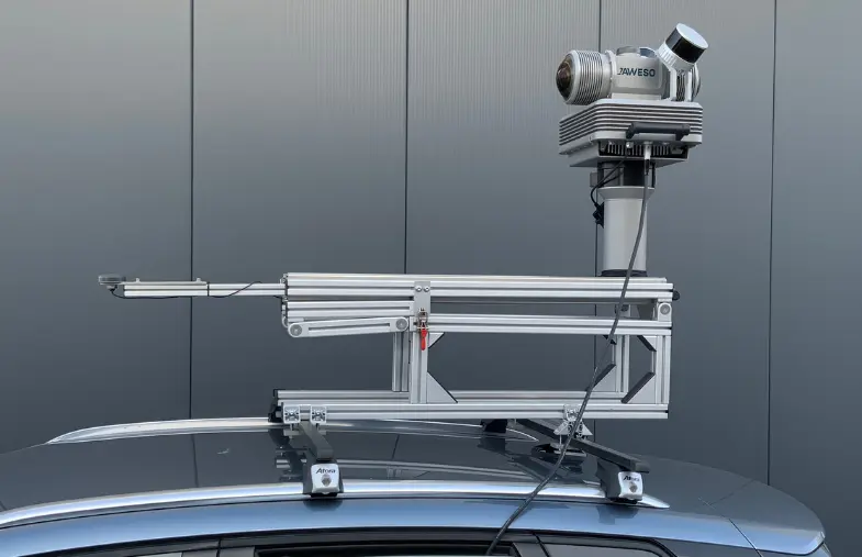
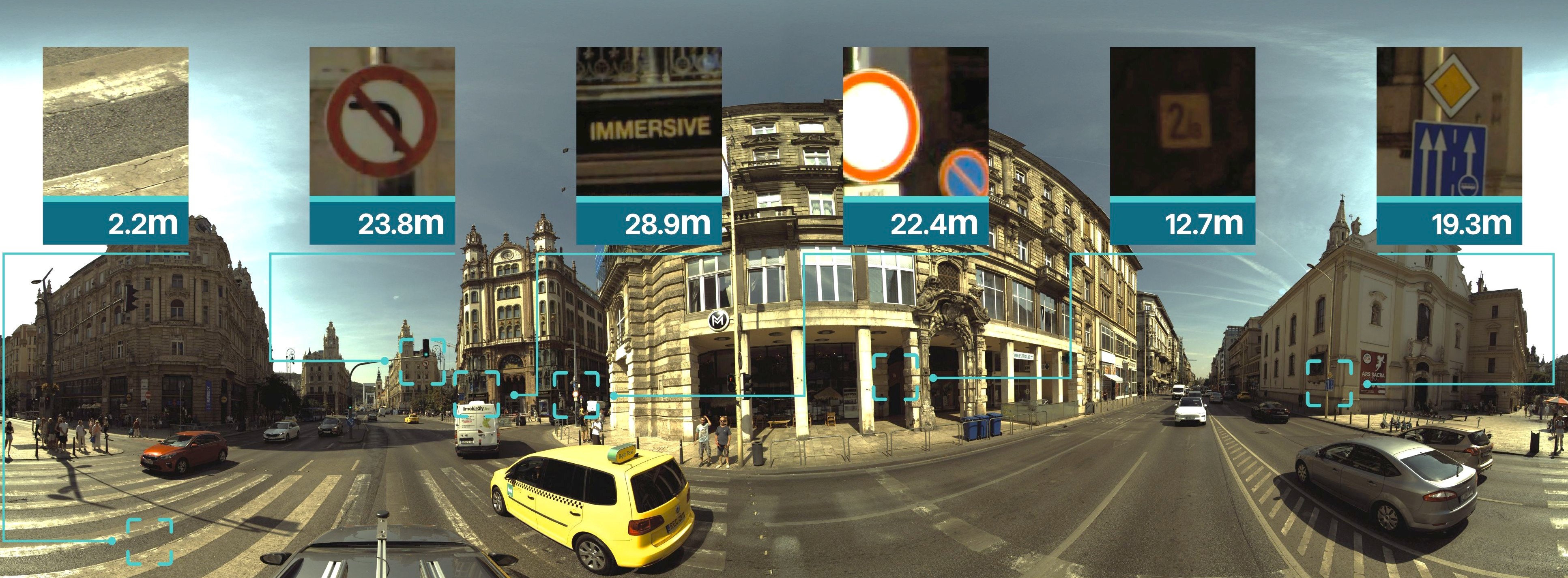
Best-in-class picture quality for Mobile Mapping.
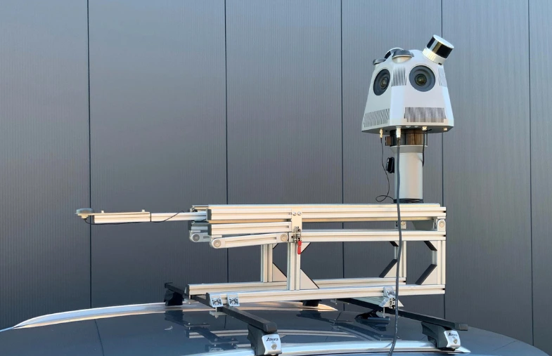
Our camera systems allow capturing of detailed street, urban infrastructure or railway industry information.
With JAWESO systems, we are setting new standards for image quality and user-friendliness in the field of Mobile Mapping.
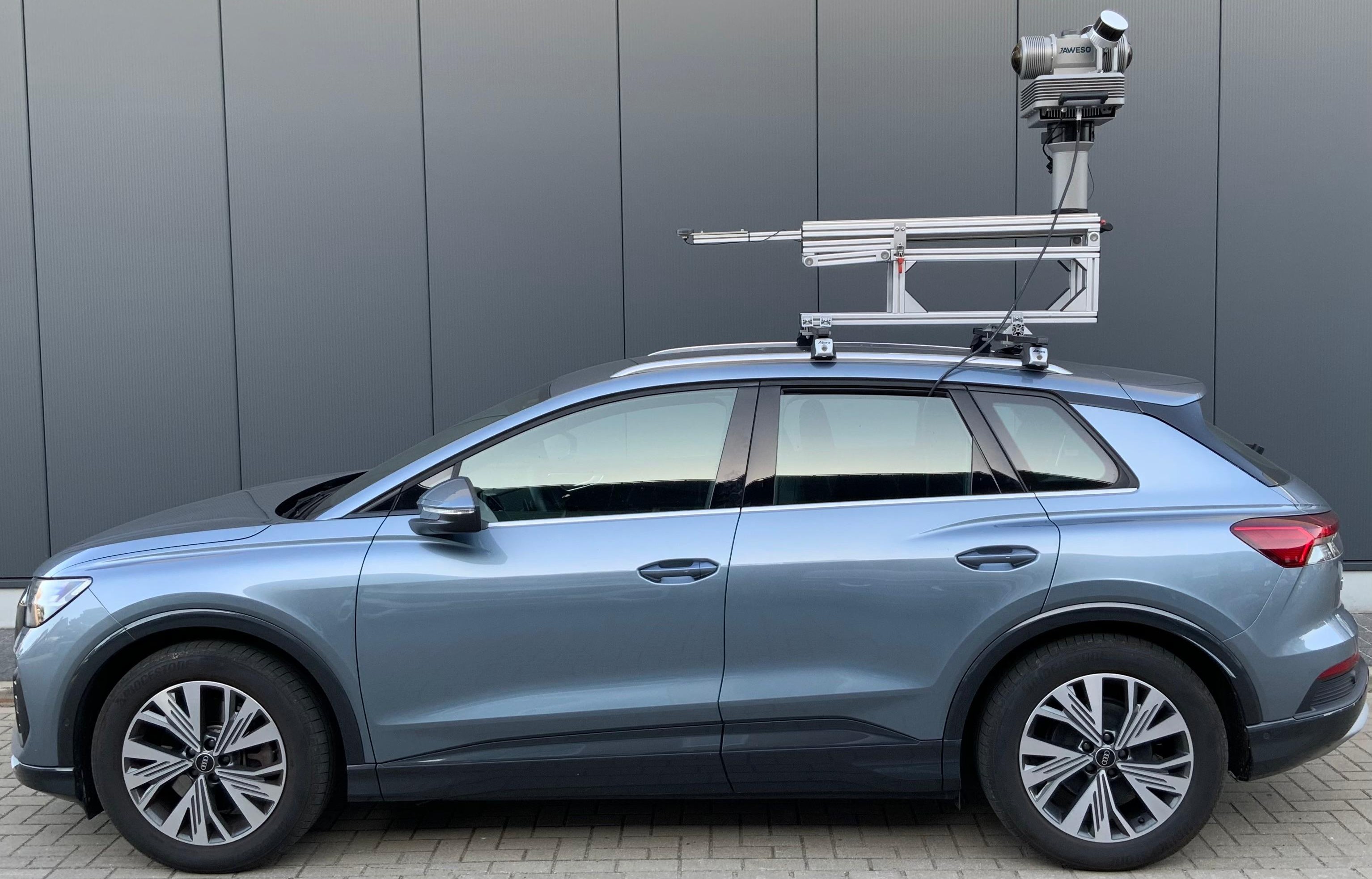
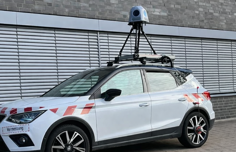
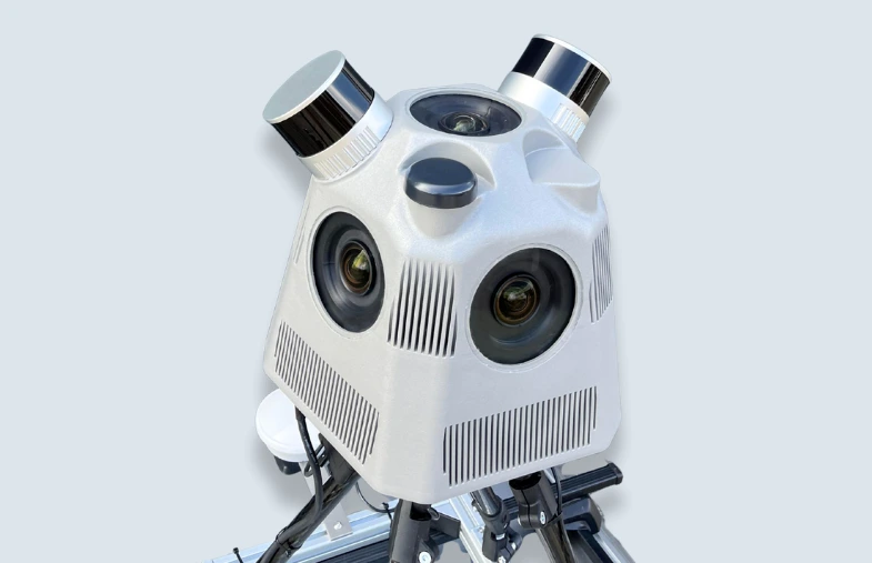
The JAWESO Panora Pro PL stands out as an all-in-one Mobile Mapping solution with outstanding image resolution in the 200-megapixel class, virtually distortion-free imaging, two LiDAR sensors and high-precision positioning for particularly demanding applications.
The JAWESO Panora PL offers a compact all-in-one Mobile Mapping solution with a 134-megapixel panoramic camera, two LiDAR sensors and precise positioning via real-time sensor fusion from RTK-GNSS, IMU, and visual SLAM.
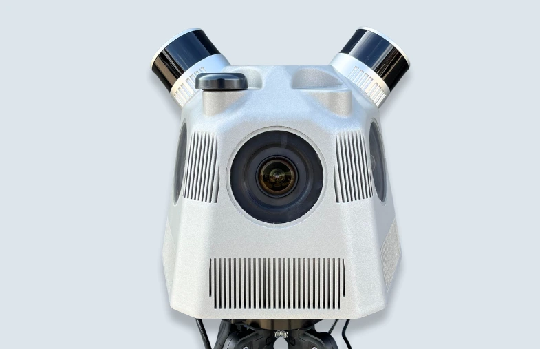
With six 24.4-megapixel cameras, the JAWESO Panora captures impressive 360° images totaling 134 megapixels. Even the smallest details at great distances become clearly visible.
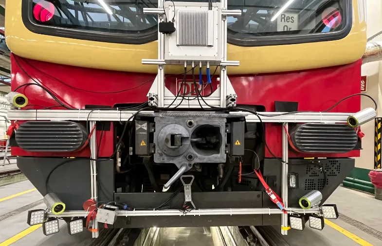
The JAWESO Planar system, on the other hand, offers an intelligent solution for operating up to six individual 24.4-megapixel cameras in a single system. The Planar cameras are particularly suitable for applications where specific areas are of particular interest, such as track surveying or traffic sign recognition.
All systems can be controlled either via frequency or NMEA/PPS, but can also be easily integrated into Mobile Mapping systems and thus controlled externally. With a maximum frame rate of 13 frames per second, they offer fast data acquisition. Installation of the systems is simple and straightforward thanks to plug-and-play mounts, the JAWESO Panora quick-release mount, and the adjustable Planar mounts. Operation is intuitive and user-friendly thanks to the browser-based web interface.
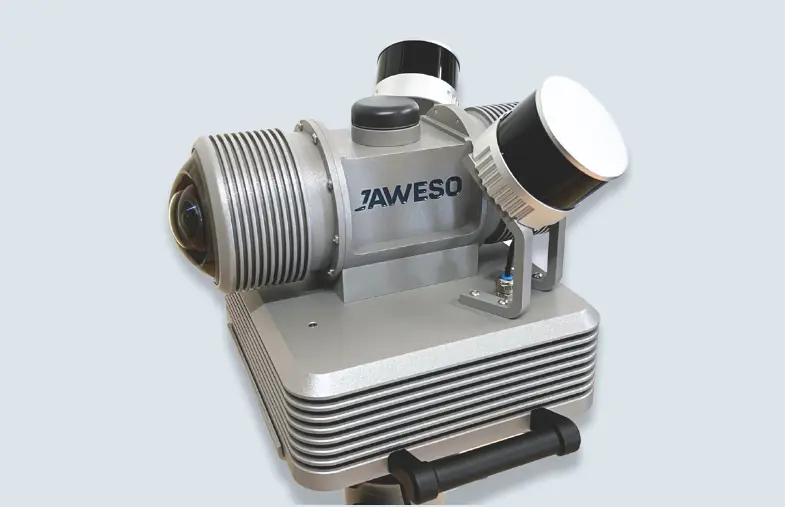
JAWESO Panora


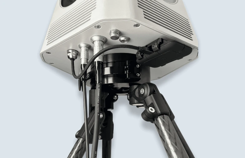
Panorama camera
- For virtual tours and generating digital twins
- 6 x 24,4 MPix single cameras
- Global Shutter
- Panorama resolution: 16384 x 8192 Pixel (134.22 MP)
- Field of View: 360° x 135°
- Protection class: IP66
- Easy integration with Mobile Mapping systems (e.g. Trimble MX9/MX50 or Riegl VMQ/VMX)
- Images are stored in standard jpg format - incl. position
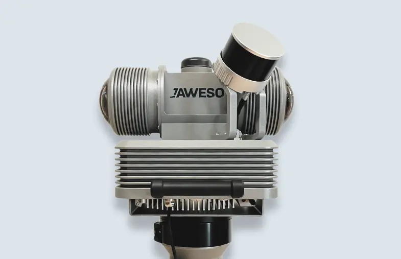
JAWESO Panora PL
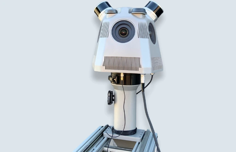
All-in-one Mobile Mapping solution
- Panorama camera:
- Panoramic image with 134 Megapixels
- Global shutter
- Field of: 360° x 135°
- LiDAR:
- 2 x 640000 Points per second, range: up to 120m
- 2 x 360° horizontal, 31,5° vertical
- Accuracy: 1-2cm
- Position:
- Real-time sensor fusion
- 2 x RTK-GNSS + IMU + visual-SLAM
JAWESO Panora Pro PL
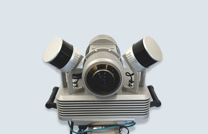

All-in-one Mobile Mapping solution with superior image resolution
- Panorama camera:
- 2 x single lens with 200° field of view
- 200 Megapixel class, almost distortion-free
- Nearly complete spherical view (horizontally and vertically)
- No stitching for half sphere - zero parallax
- Extreme dynamic range, sharpest images possible
- LiDAR:
- 2 x 640000 Points per second, range: up to 120m
- 2 x 360° horizontal, 31,5° vertical
- Accuracy: 1-2cm
- Position:
- Real-time sensor fusion
- 2 x RTK-GNSS + IMU + visual-SLAM
JAWESO Planar System
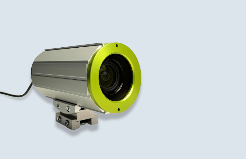

Planar camera
- For detailed visualization of regions of interest
- Meets the requirements of Deutsche Bahn (DB) for ‘video recordings’ in connection with MSS data recordings according to Ril 883 and has been successfully used in this context
- Up to 6 cameras with 24.4 MPix each in one system
- Protection class: IP67
- Field of View: 47° x 60°
- Global shutter
- Easy integration with Mobile Mapping systems (e.g. Trimble MX9/MX50 or Riegl VMQ/VMX)
- Images are stored in standard jpg format - incl. position
PORTFOLIO 2026
Download our portfolio for an overview of our high-resolution Mobile Mapping systems.
Very high resolution for maximum flexibility
The high resolution of our systems is crucial for precision and attention to detail. The environment can be captured with breathtaking clarity and sharpness. This exceptional level of detail provides precise and reliable mapping data, which is indispensable in various industries.
Whether planning construction projects, visualising urban landscapes or supporting autonomous vehicle technology, the high resolution of our Mobile Mapping Systems opens up new possibilities for innovation and progress.
JAWESO Panora Pro PL - 200 MPix
JAWESO Panora PL - 134 MPix

Get in touch!
Contact us for inquiries, questions and personal consultation.